
PROJECT CASE STUDY
Client: Jewell Associates Engineers, Inc., an engineering, architectural, and surveying firm headquartered in Spring Green, Wisconsin
Location: CTH T, Iowa County, from Barneveld to CTH H
Services: UAV LiDAR
Team Leads: Kristin Belongia, PLS, VP of Survey; DeWayne Manon, Senior Project Surveyor and Drone Pilot
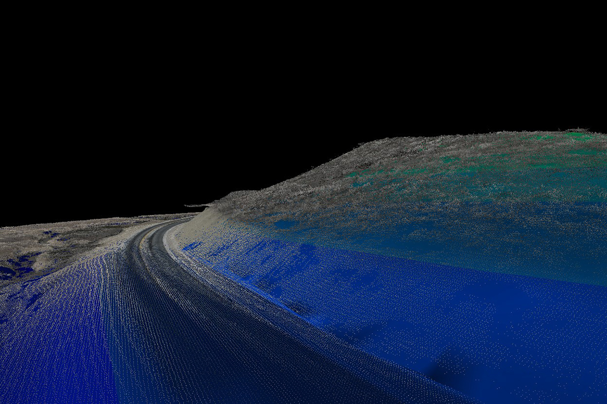
Batterman’s LiDAR UAV tech and crew safely and efficiently assist with the topographic survey of this roadway’s challenging terrain.
While executing a topographic survey of County Trunk Highway T using conventional survey methods, Jewell Associates Engineers, Inc., was faced with steep slopes and dense vegetation surrounding this roadway, which posed significant challenges and safety concerns for the survey crew. To meet this challenge, Jewell partnered with Batterman for aerial survey assistance, leveraging LiDAR UAV technology to safely, accurately, and efficiently supplement their data.
Project Scope
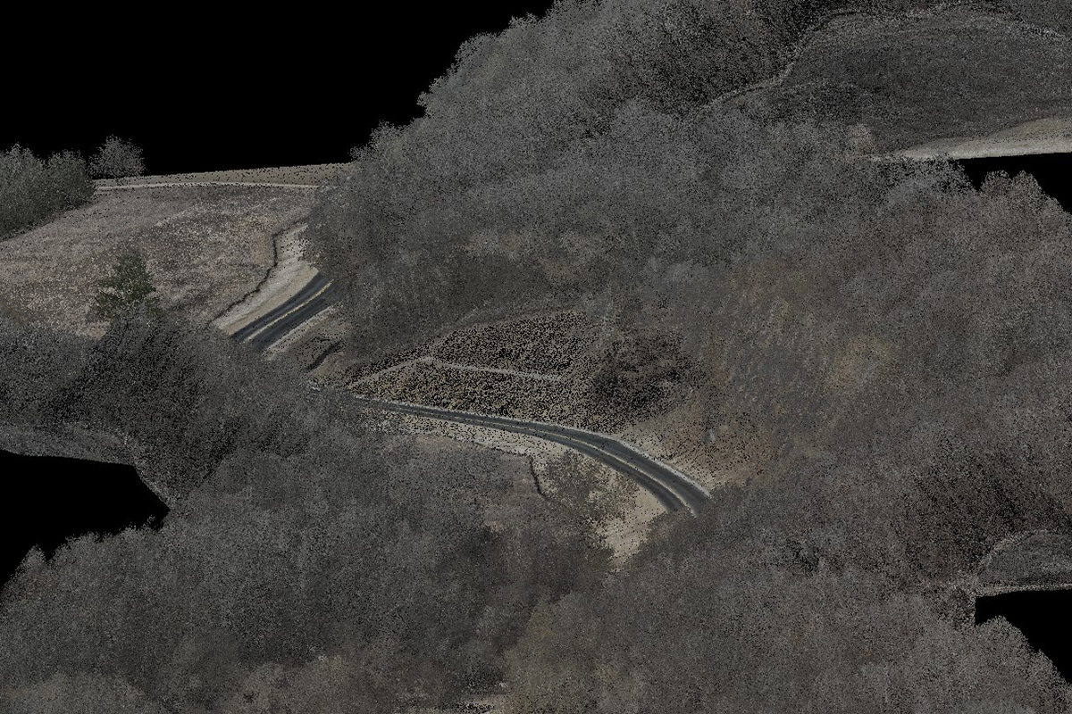
The project involved utilizing Batterman’s LiDAR UAV team and technology to perform an aerial survey, capturing topographic data of approximately 7 miles of rural roadway, including roadside ditches and adjacent terrain.
Challenges Faced
The steep and varied terrain made it difficult to maintain a consistent visual line of sight with the UAV.
Flying at a constant altitude was challenging due to the significant elevation changes throughout the survey area.
Ensuring the accuracy of LiDAR data required effective validation against conventional survey measurements.
Solutions Implemented
Pre-planned Takeoff and Landing Zones: Over a dozen takeoff and landing spots were identified and utilized to optimize UAV operations.
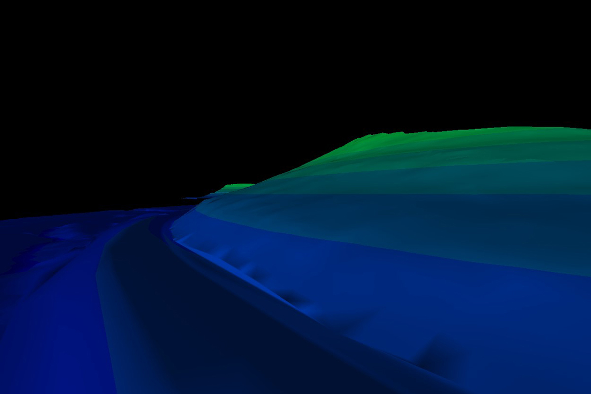
Terrain Following Mode: The UAV was programmed to automatically adjust its flight altitude based on the terrain below, ensuring a consistent data collection height and improving accuracy.
Ground Control and Checkpoints: Multiple ground control and checkpoint targets were set and measured using conventional survey techniques. These points served as benchmarks to validate and ground-truth the LiDAR-generated point cloud.
Final Outcome
Implementing LiDAR UAV technology resulted in a highly detailed and accurate topographic dataset in a fraction of the time. Data collection in the field, processing, and delivering results took about one week, whereas obtaining the same dataset through conventional survey methods would have taken one to two months. The final point cloud comprised approximately 300 million data points, providing an extensive and precise representation of the surveyed terrain. By comparing the LiDAR-generated data with conventional ground control points, the average difference was determined to be 0.06 feet, with a standard deviation of 0.13 feet. The use of UAV technology significantly improved survey efficiency and safety, reducing the need for field crews to navigate hazardous terrain.


Learn more about our survey services | Request a quote
Contact the VP of Survey, Kristin Belongia, PLS